■ Impact:★★★☆☆
■ Scenic Appeal:★★★★★
■ Sense of the Extraordinary:★★★☆☆
Northeastern Arizona in Navavo reservation. Overlooking the divine Spider Rock on the Indian Reservation, I feel the special space where different time is flowing.
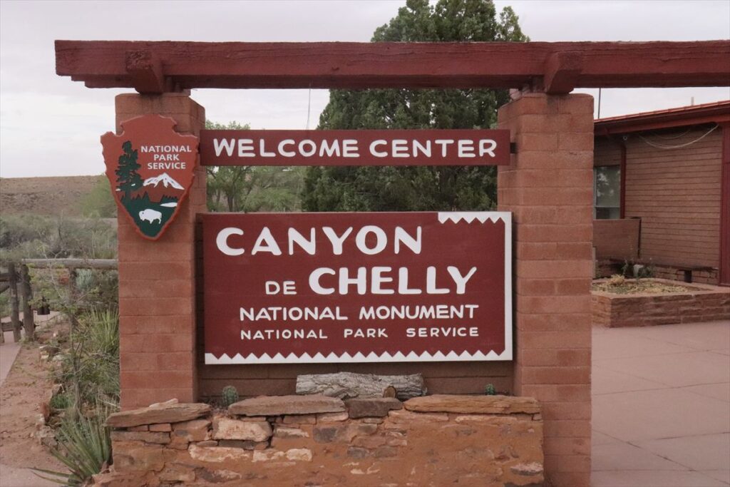
This is the National Monument located in the Navajo Reservation area. This is in the remote area. I guess, the way to reach this place will be either “Grand Canyon”, “Glen Canyon (Page)” in the west side, or “Gallup” in the east side.
There is a town ; “Chinle” around the entrance of this place, which is incredibly small, though it is like big town on the map. There are a few motels and restaurant. There are limited places to eat in a town with a few buildings. I went to the restaurant and had dinner. It was full of people and the locals were singing while playing percussion instruments. There was no atmosphere of dealing with tourists, which was mysterious.
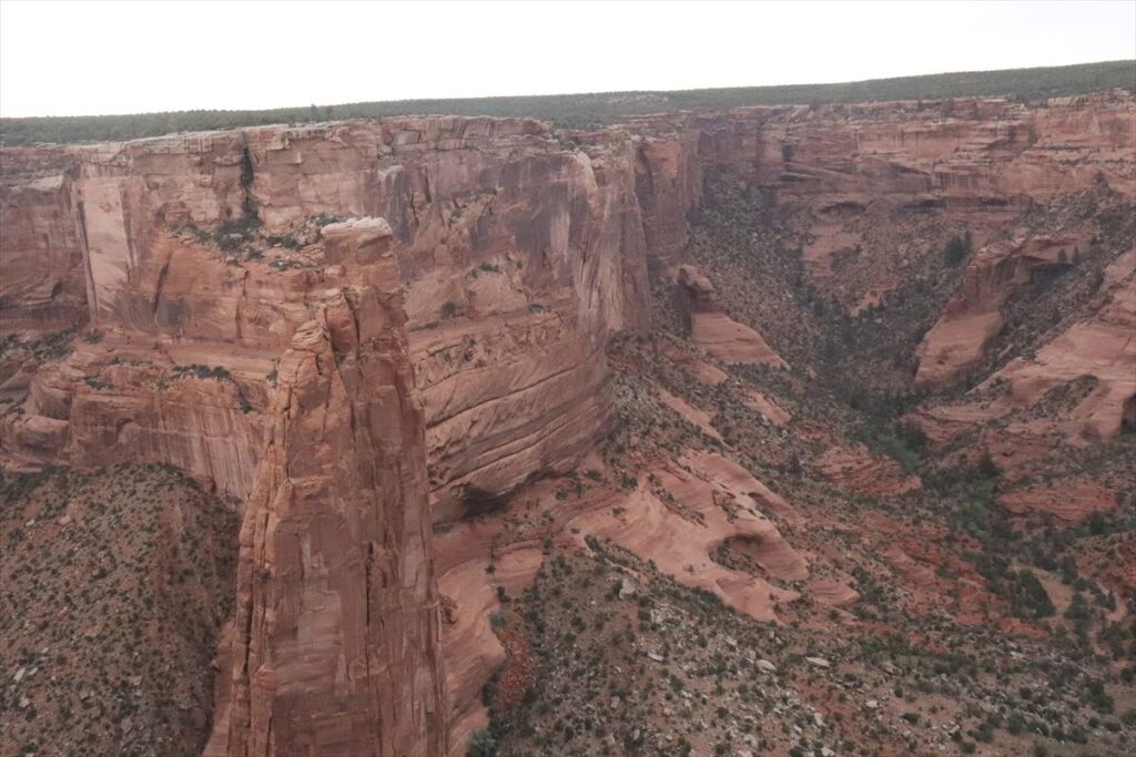
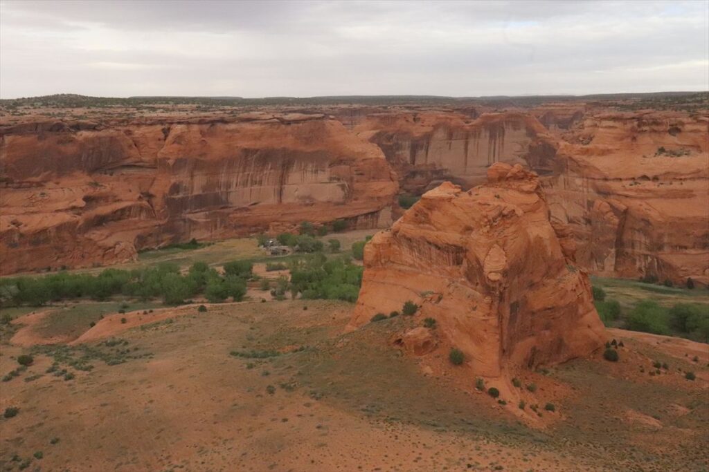
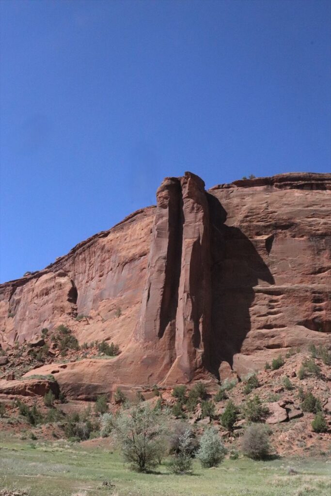
Well, it is the best choice going to the “Spider Rock” in this “Canyon de Chelly”. This “Spider Rock” has approx. 200-meter height, and this is a rare type of rock tower. There is the same kind of rock tower called “Three Sisters” in the “Monument Valley”, but it is a little different. “Spider Rock” is standing in the center of the valley surrounded by the rock cliffs, and can feel the wind in the valley.
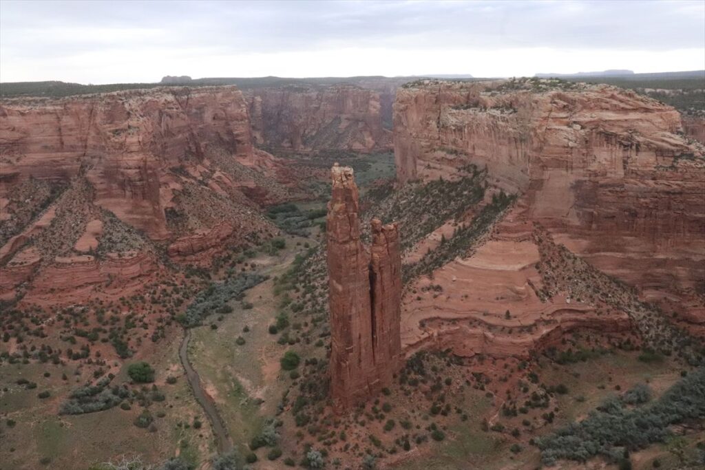
At the view point to look down the “Spider Rock”, it looks like it is just in front of my eyes. In addition, there are a few people in the view point and therefore, you can enjoy its amazing view freely. This place has the different time frame and you will feel the different dimension at the very quiet environment.
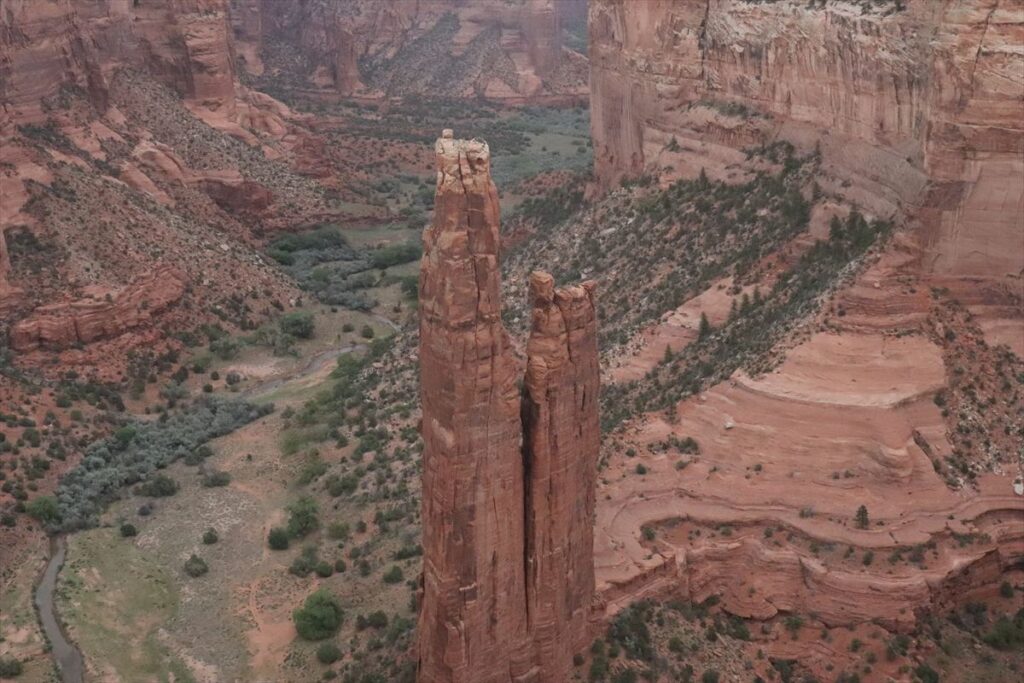
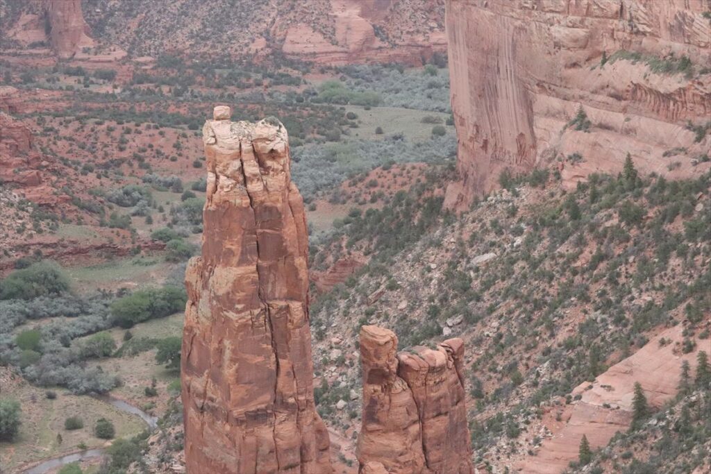
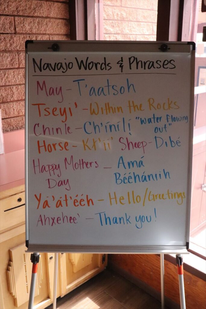
According to a guide who led a tour in 2024, the most sacred places in Canyon de Chelly National Monument are Spider Rock and the White House. Spider Rock consists of two stone towers, with the one on the left representing the mother and the one on the right representing the daughter. A bit further to the left of these two stands another solitary rock called Face Rock, which is said to represent the father. Together, people see these three formations as a “Family,” though many do not widely know or commonly share this interpretation.
✓ Private Tour of Canyon de Chelly
I revisited Canyon de Chelly in 2024. I wanted to see Spider Rock from below, having only viewed it from the overlook before. There are several local tour companies in the area, and I chose one called Tseyi Jeep Tours because they offered an option that takes me all the way to the base of Spider Rock.
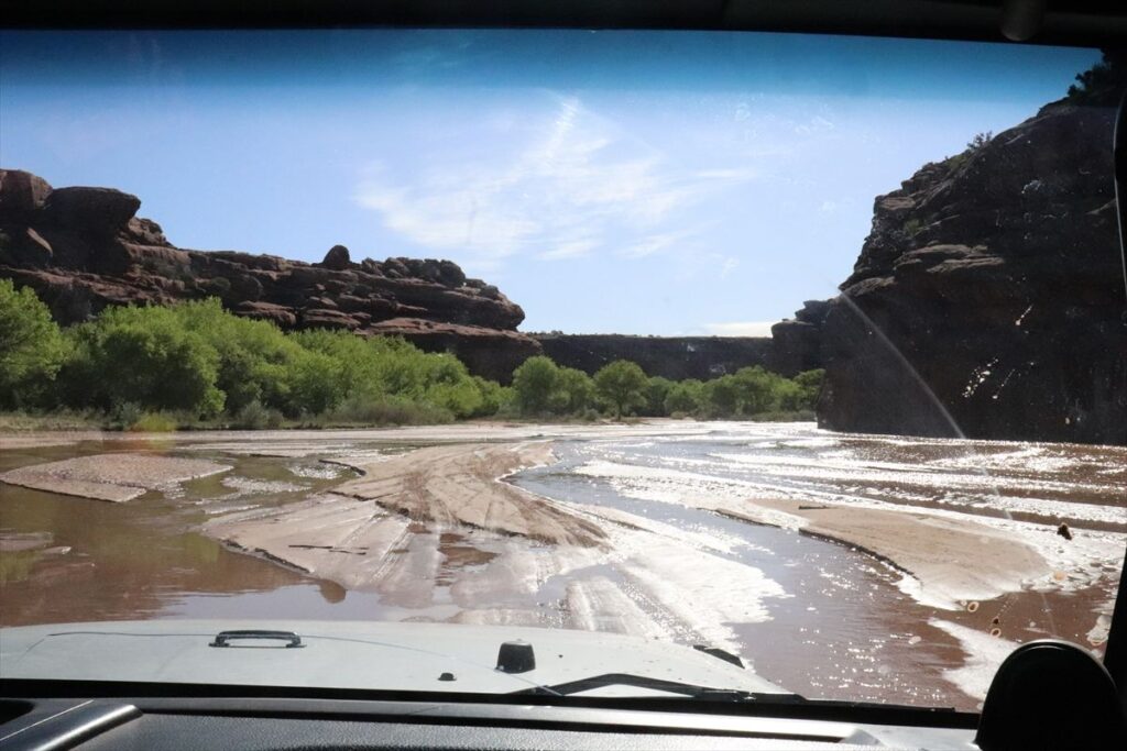
I met my guide at 9 a.m. at the visitor center. He was an older gentleman named Bobby. In fact, he had informed me the day before that we might not be able to reach Spider Rock. When we first met, he explained that it had rained about five days earlier, causing the river level to rise. Therefore we would indeed not be able to go all the way to Spider Rock. Normally, the trip to Spider Rock takes five hours, but since that wasn’t an option, we shortened the tour to three hours and turned back just before reaching the rock.
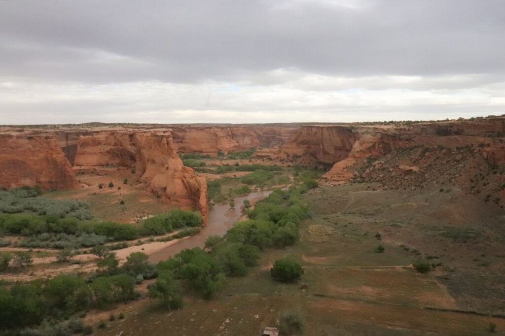
The canyon floor contains the White House, Mummy Cave, and Spider Rock. Around the area of Spider Rock, the canyon floor lies about 300 meters below the rim, and the tour actually takes you down to this lower level. This naturally raises the question: how do you get down to the canyon floor?
The answer is that the western part of the park where the visitor center is located, provides access to the river that runs along the bottom of the canyon. This is the entry point to the floor. In other words, the park spreads out in a fan shape from west to northeast and southeast, and the land has been eroded over time by the flow of the river.
First, we turned right just before Thunderbird Lodge, which is near the visitor center. There, we parked in a designated lot for tour participants and transferred to the jeep that the tour guide had arrived in. We then headed to the Navajo park office inside the monument, where we paid the entrance fee, $8 per person, and filled out a form with our name and address, followed by a signature.
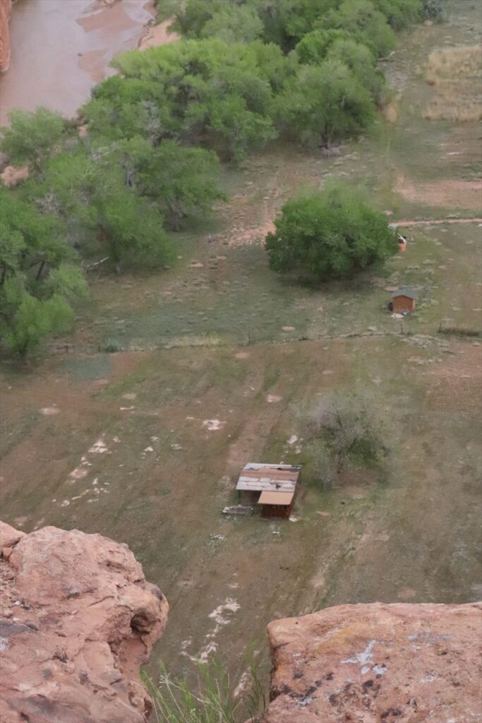
After driving for a while in the jeep, we reached the river. We continued along the shallow river and the dirt path that runs beside it. The greenery of the trees surrounding the river was vibrant, and the sunlight reflecting off the water’s surface created a beautiful scene. It was a striking contrast to the impression I had when viewing the canyon from above.
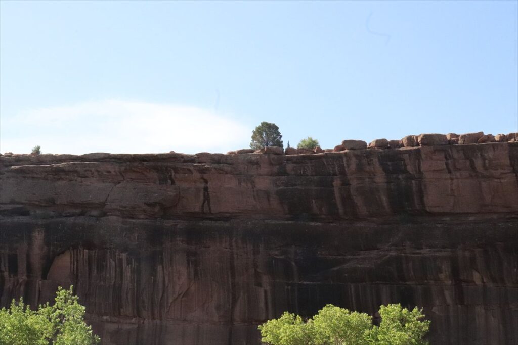
The jeep stopped at various points along the way, where the guide provided explanations. When we reached places where people had painted drawings on the cliffs, the guide used a small mirror to reflect light onto the images high up on the rock face while explaining the history of the site. Interestingly, the fact that the drawings are located high on the cliff suggests that the river further eroded the land after the paintings were made.

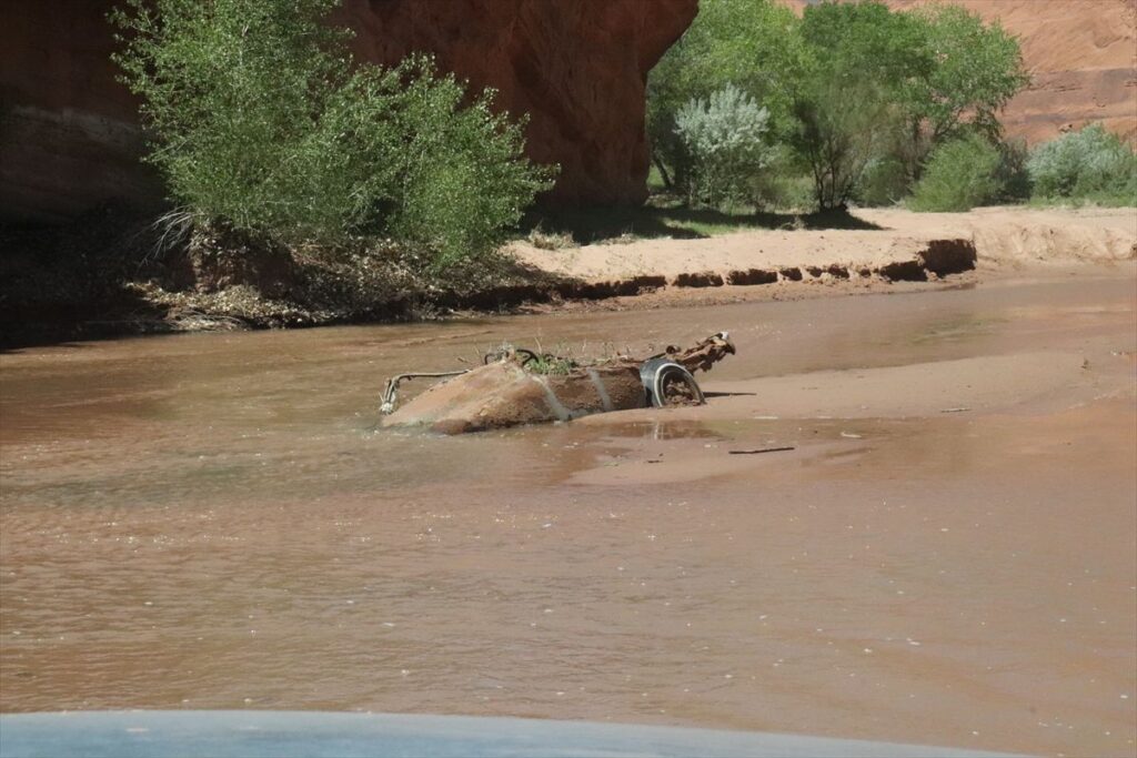
Along the way, we came across a jeep that had gotten stuck in the river. It was tilted and partially submerged near the riverbank. Standing nearby were three people who looked helpless and unsure of what to do. After briefly speaking with them, our guide continued driving while making a phone call on his mobile. It seemed he was explaining the situation, and the conversation was in English.
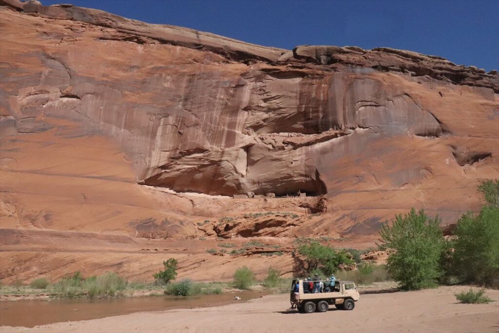
After stopping at several points for explanations, we arrived at the White House. This dwelling site dates back to the Ancestral Puebloan (Anasazi) period and resembles the ruins found in Mesa Verde National Park. According to our guide, the Anasazi lived here around the year 1200, but a prolonged drought, lasting about a decade, forced them to abandon the area. Later, around the 1700s, the Navajo arrived and settled in this place. People say that the Anasazi who left became the Hopi people, who now live on a reservation in a different location, within the Navajo Nation in Arizona.
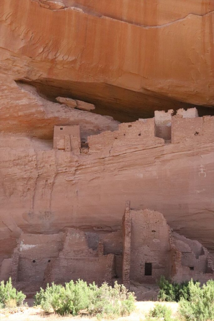
It was explained that the origin of the Anasazi is unknown. The Navajo came down from the north, where Alaska is located, so their culture and language are different from those of the Hopi.
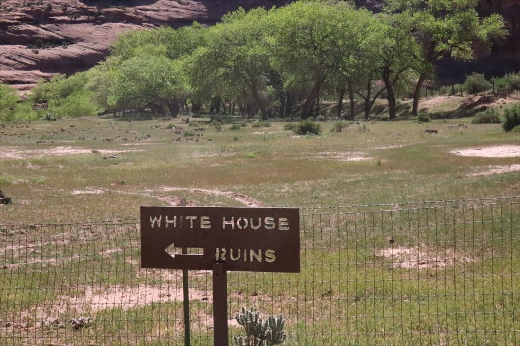
You can walk from the bottom of the White House canyon all the way up to the top of the cliff. This path is called the White House Trail. I climbed up a little from the bottom along this trail, and just before reaching the canyon floor, there was a tunnel-like section. Beyond that tunnel, the rock layers were formed in a way that reminded me of “The Wave” in Arizona.
I turned back at the White House and returned to the starting point, Thunderbird Lodge. The time taken was exactly the planned three hours. Spider Rock is quite a bit farther from the White House, so even five hours might be too short to get there.
“Can you get to Spider Rock in five hours?”
On the way back from the White House, after hearing a guide talking with some people in a passing car, I asked this question because I heard they were planning to try going to Spider Rock.
The guide laughed and said, “It will be tomorrow morning.”
It was said that there is no problem reaching Spider Rock as long as it doesn’t rain. Since I visited in early May, it seemed a bit too early. By late spring or summer, the river dries up. Personally, I was a bit disappointed not to achieve my goal, but since I need to come back, I want to return there in the future.
The guide said that he was born and raised at the bottom of the canyon but now lives up above. Many people have homes both up and down; they live down below in the summer and up above during the rest of the year.
Lastly, I would like to include one conversation with the guide.
“I came here about 20 years ago. At that time, there were only a few hotels and restaurants in the town of Chinle. Now there is a Dennys, but I don’t think there was one back then. Also, 20 years ago, I went into a restaurant that was packed with locals. I remember there was someone playing percussion instruments for the visitors.”
“Yeah, that must be the Junction Restaurant at the Best Western.”
“Oh, that might be it. I do remember the Best Western was there even then.”
“That’s right, the Best Western. I was the one playing percussion there, you saw me at that time.”
The guide said this with a laugh.
Moreover, I recommend you drive the Navajo Reservation area in addition to this “Canyon De Chelly”. The recommended route is as below.
【Recommended Course-A】
Page – 89/160 — Tuba City – 264 – 191 – Canyon de Chelly – 160 – Four Corners – 160 – Kayenta – Monument Valley – 163 – 98 – Page
A course starting from Page, Glen Canyon is located, then go around, via Canyon de Chelly, Four Corners, and Monument Valley.