■ Sense of Escape★★★★★
■ Reset Value★★★★★
■ Low Public Recognition ★★★★☆
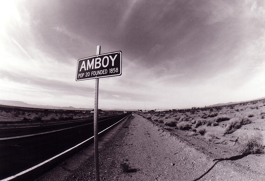
Wilderness in southeastern California, USA. Wander around the ghost town in the wilderness and experience the world of “nothing”.
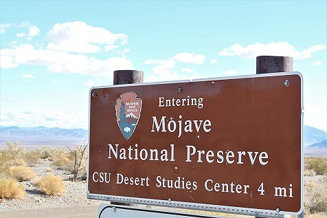
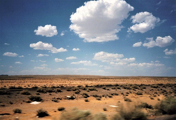
This is a desert in southeastern California, USA. The name is Desert but there is no sandy area and therefore it is appropriate to say “wilderness” to be exact. The location is, about 50km east of Los Angeles on Insterstate-10, then after changing to Interstate-15 heading north, Mojave Deserst is the entire area up to around Nevada. The place symbolizes Mojave Desert, where the name “Mojave” is used, is the “Mojave National Preserve”, which stretches to the east of the town of Baker on Insterstate-15, and there is a ghost town in this area.

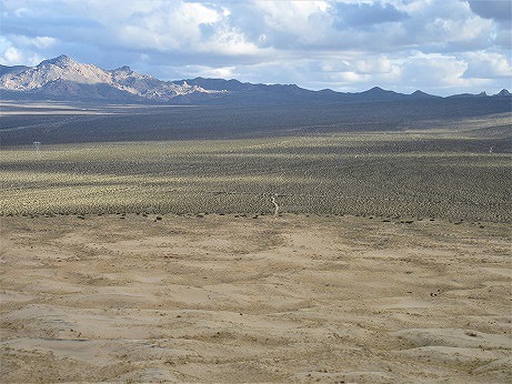
There is nothing special about this place. It is a world where “nothing” spreads. There are many places like this in the western United States, but the advantage is that it is accessible by car. It is basically an empty wilderness, but to the north of the Preserve is the Joshua Tree habitat, and to the south is the dunes in the name of Kelso Dune. The Joshua Tree is greater size and quality than the “Joshua Tree National Park”, which is about 160 km south.

Although the preserve is essentially a world of “nothing”, there are several places that add character to the landscape. I have visited this area several times since 1994. In this article, I describe the landscapes I encountered over the years, the changes that have taken place in Mojave National Preserve, and the noteworthy places scattered throughout the preserve.
Kelso
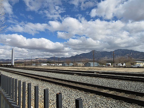
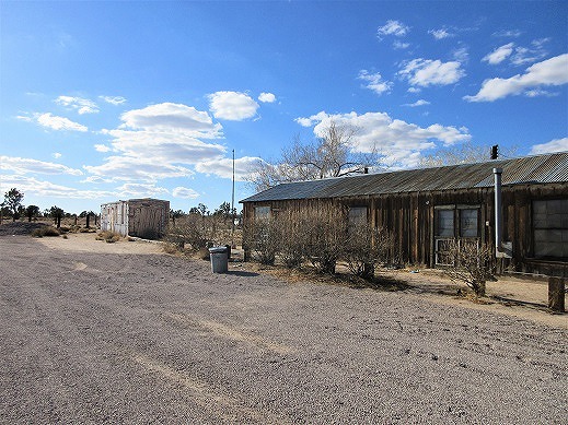
This is in 60 km from Baker, 40 minutes by car. A very few car on the road leading from Baker. As the wilderness continues, I impressed when I see this town called “Kelso” in the distance. Trees are densely packed only in this place, and can see the tall tank that stores water and people live there.
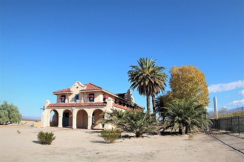
There is a railway station with European-style building in this place. This is functioning as a railway station. This European-style building feels a bit disproportionate to the wilderness, but this mismatch gives it a nice taste. The building is currently as a visitor center for the Mojave National Reserve. When I first visited 1994, the building was left unattended, and there were only two simple toilets standing beside the building.
Currently, public toilets are installed, and there is an exhibition about this Preservation area inside the building, which is functioning well. The railroad tracks run beside the building, and the view of the railroad tracks and the surrounding buildings from the railroad crossing is wonderful.
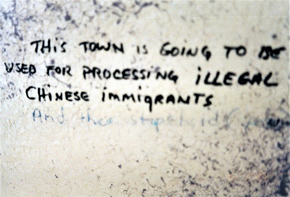
When I visited in 1994, there was graffiti on the simple toilet.
“This Town is going to be used for processing illegal Chinese immigrants”
It is a high-level American joke.
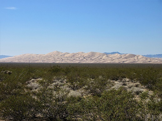
Kelso Dune
A sand dune about 20 minutes drive south of the town of “Kelso”. This place can be seen far from the town of “Kelso”, but it appears in an unidentified place. As driving, gradually finding that this unidentified place on the right is like a dune. It is a mysterious space why there are such dunes in this wilderness. There is a trail to the dunes. After about 10 minutes drive south from the Kelso, there is a dirt road on the right and after about 10 minutes drive, reach the entrance of the trail to the dunes.
There are few people, but I could see people who are trekking. It takes about 20-30 minutes walking to the top of the sand dunes. It is more than 100m high from the foot of the mountain, but the wilderness that stretches to the east from the top is beautiful as looking at artwork.
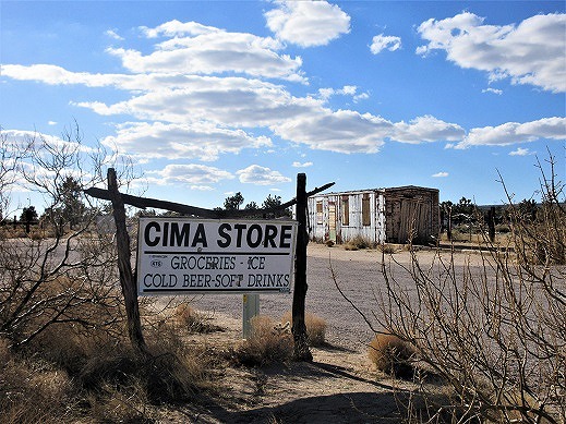
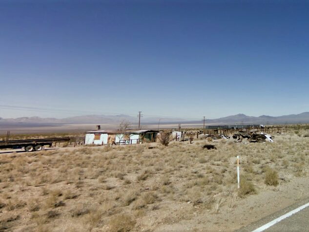
Cima
A ghost town about 20 minutes drive on Cima Road, which extends northeast from the town of “Kelso”. There is a building that was a general store on the side of the road. It closed, but I remember that it opened in the 1990s when I passed by. According to the record when I visited in 2002, the post office next to the general store opened.
There is a sign that describes “Cima Store” on the side of the road and it is good picture. In addition, this place is a shortcut for people coming from Interstate-40 running south to “Las Vegas” via “Kelso”, so car is running unexpectedly.
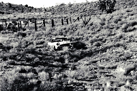
Ivanpah
Drive north from Cima, turn right at the crossed Ivanpah Road, and drive about 10 minutes to the ghost town. I looked around the area from where the town was supposed to be, but there were only two houses. It looks like no one lives. Going forward the continued road, it feels like a mountain dirt road, and there is a ghost town called “Vanderbilt”, but nothing more than “Ivanpah”.
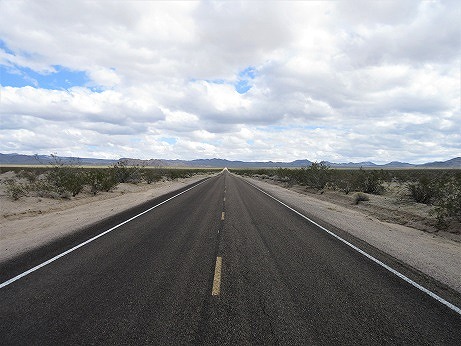
In addition, the road that runs north from Cima mentioned at the beginning and faces this Ivanpeh from the place where it crosses Ivanpah Road is a superb view. On a straight road, you can see the scenery of the road being sucked into the hill in the distance.
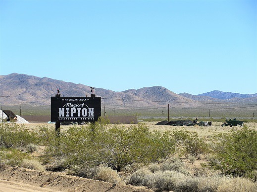
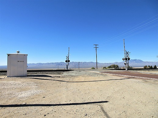
Nipton
Drive north from Cima and turn left at the crossed Nipton Road. After running for about 10 minutes, reach National Road-64, then turn right. This town just under 10 minutes away. There are general store, restaurant and hotel that still open. This is a small village. A railway runs alongside the village, and the railroad crossing that crosses the railway and the view of the wilderness beyond are spectacular.
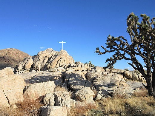
White Cross World War I Memorial
There is a memorial to the war dead of World War I on the side of the road, 10 km north-northwest of Cima. A cross on a rock called Sunrise Rock. A quiet place with no one around. Joshua Tree inhabits the area around this place. It breeds more than “Joshua Tree National Park”, and can see picturesque scenery everywhere. If going to see Joshua Tree, I think you should come here.
The above locations can go around in a day without trekking to the “Kelso Dunes”. You can eat and drink at the visitor center in “Kelso”, where snacks are available, and at the general store in “Nipton”. There is a restaurant in “Nipton”, but it closed when I visited three times, so do not expect it.
These are valuable places where can experience “nothing” and “unusual space”. By all means, I would like you to wander around and make your mind to “nothing”.
Visited multiple times since 1994. The last time visited is 2018.
Basic Information
■ Name of Place : Mojave Desert / Mojave National Preserve
■ Homepage : https://www.nps.gov/moja/index.htm (Mojave National Preserve)