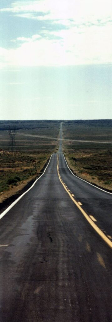
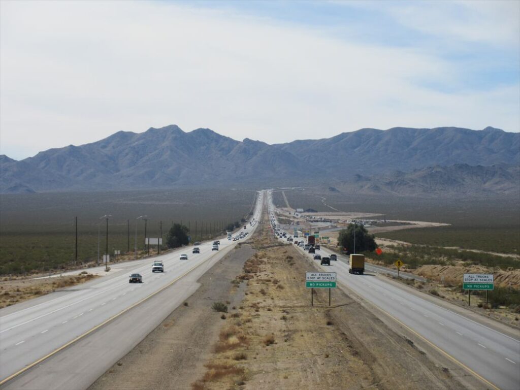
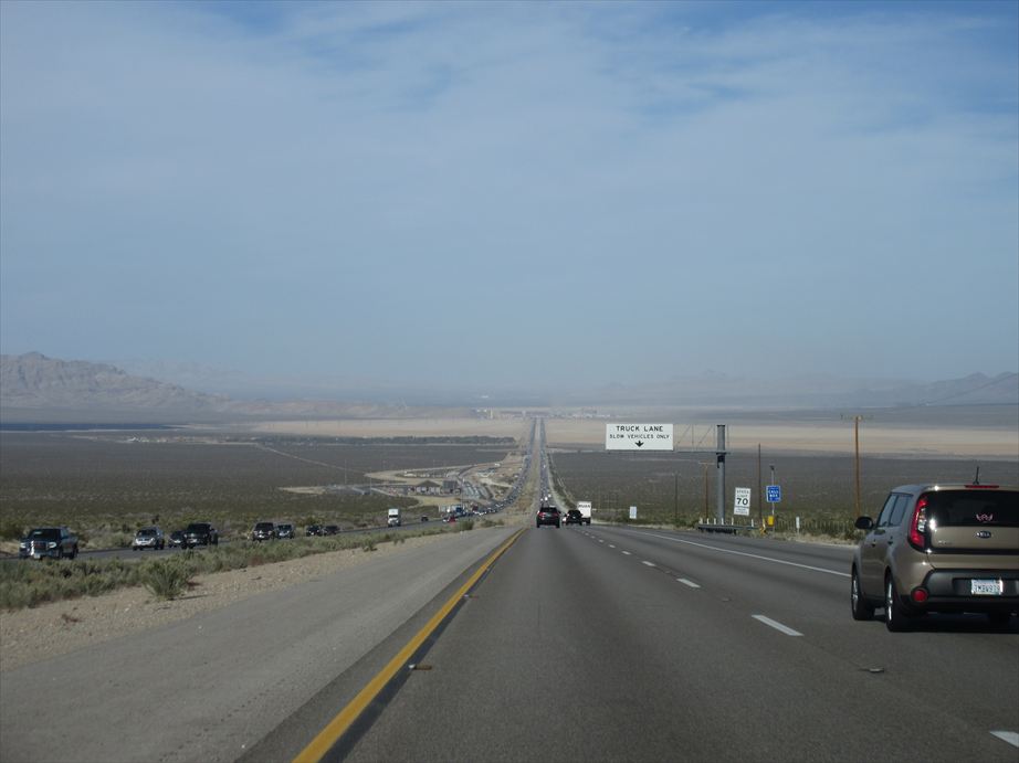
Standing before a straight road cutting through the wilderness, I fix my eyes on the vanishing point in the distance, and my mind is filled with nothingness.
When driving through the wilderness in America, I sometimes come across a straight road stretching endlessly ahead. Seeing a sight so rare in Japan lifts my spirits, and I pull over to the side of the road. With almost no cars around, I brake sharply from high speed and steer toward the shoulder. The gravel surface, uneven edge, or patches of grass make the car jolt as it stops. When I look ahead from where I’ve parked, the scene is often different from what first caught my eye. I make a U-turn on the empty road, go back, and look for a better spot to stop.
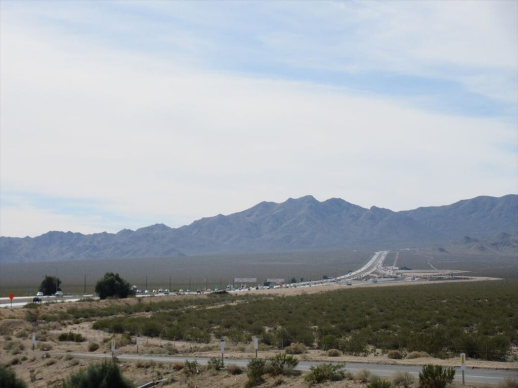
In America, once I leave the city and drive through remote areas, I often come across perfectly straight roads with little effort. Here, I would like to introduce a few places that left a strong impression on me. Since I have photographs from these locations, it means I must have stopped the car in the middle of the wilderness to take them — a sign that the scenery resonated with me in some way. Although each place is far from the city and not easy to reach, I hope this will serve as a reference when visiting nearby scenic spots.
■ Ivanpah Road (Carifornia)
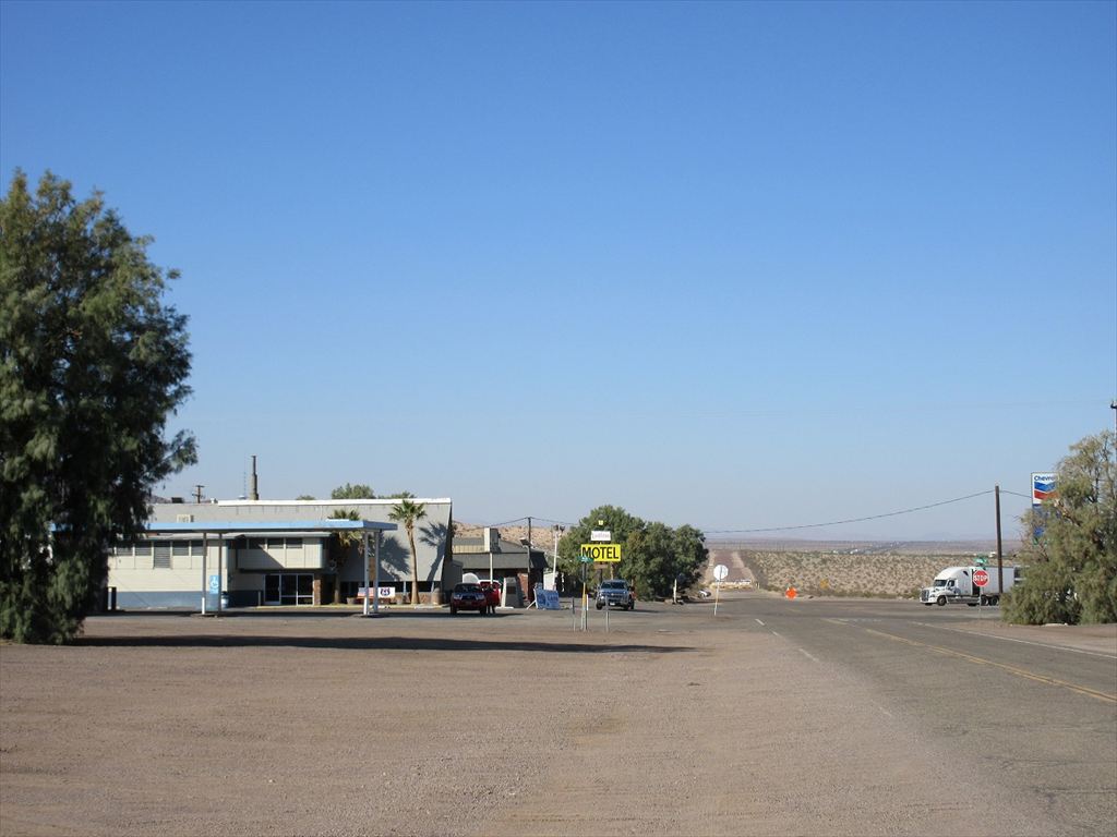
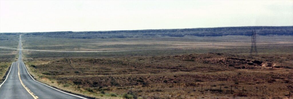
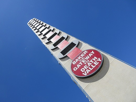
This road lies in the southeastern part of California, within the Mojave National Preserve — essentially in the heart of the Mojave Desert. East of a small town Baker, which sits along Interstate 15 connecting Los Angeles and Las Vegas, the preserve offers a striking variety of landscapes: Joshua tree habitats, sand dunes, and ghost towns. There is a town named Ivanpah on the northeastern edge of the preserve. When leaving the interstate and entering the Mojave National Preserve toward Ivanpah, this perfectly straight road appears along the way.
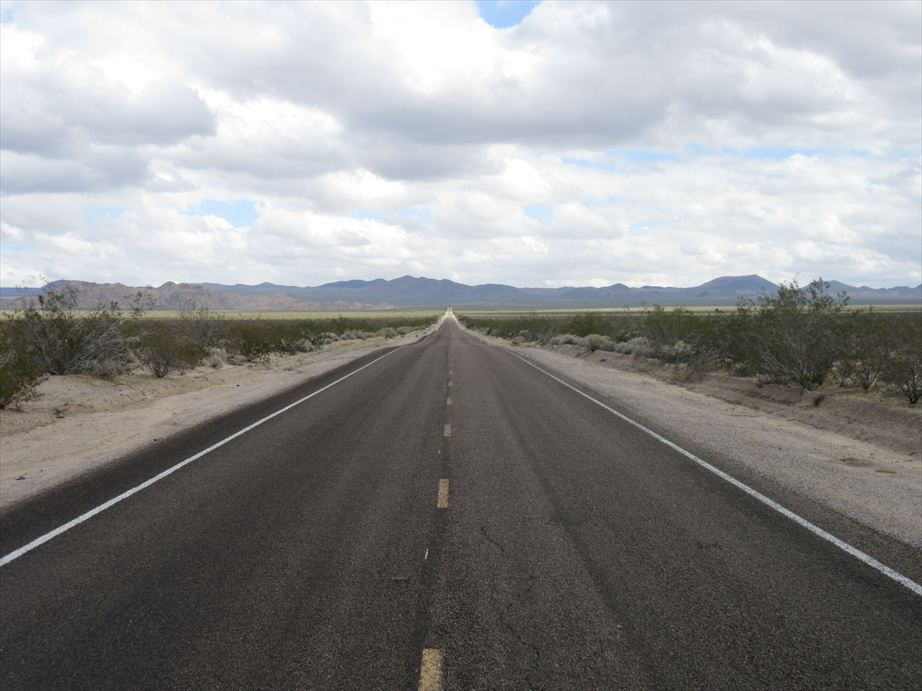
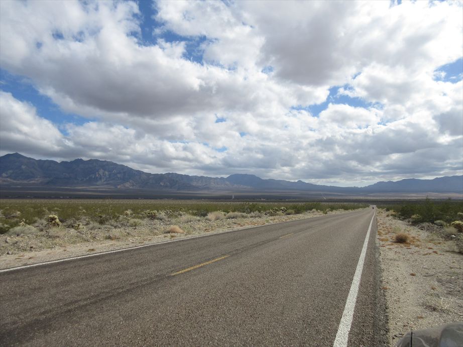
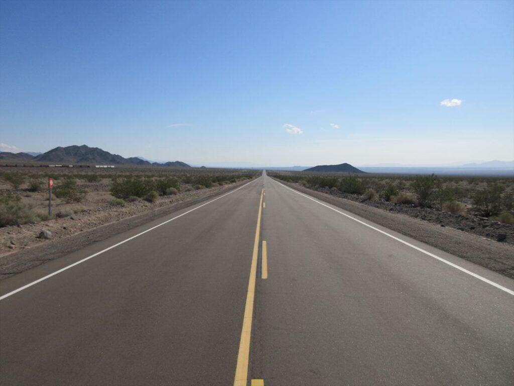
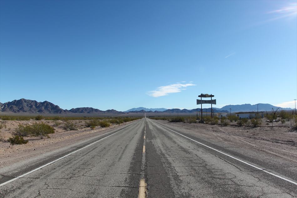
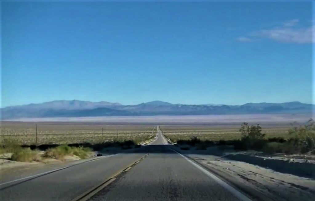
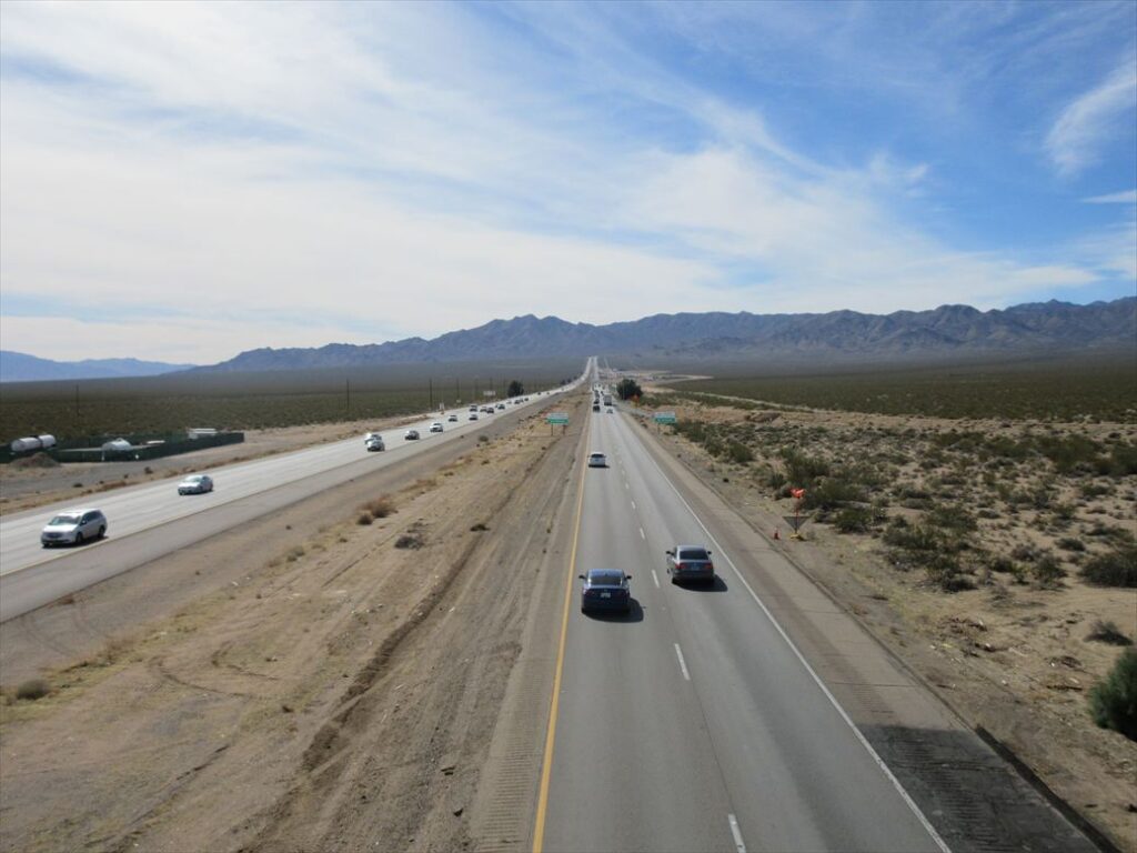
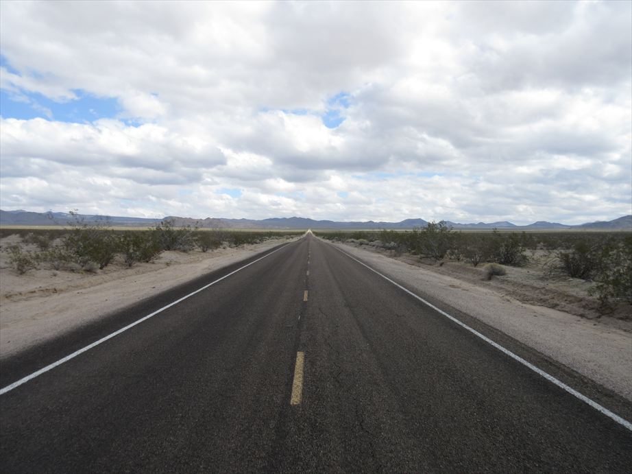
The route starts by taking Exit 286 from Interstate 15 and heading east on Nipton Road. After driving about six kilometers, a road appears on the right — this is Ivanpah Road. Following Ivanpah Road for four kilometers, the road begins to curve gently to the left. From that point, the perfectly straight stretch begins. The straight section extends for about eleven kilometers, with the road clearly seen disappearing into the hills ahead. Patches of green shrubs and desert brush dot the open wilderness on both sides.Standing at the beginning of the straight stretch, one can see how the road gently slopes downward, then rises again toward the hills, allowing the entire line of the road to be visible.

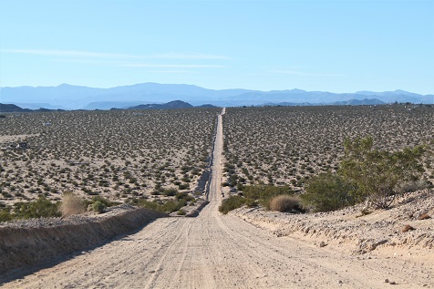
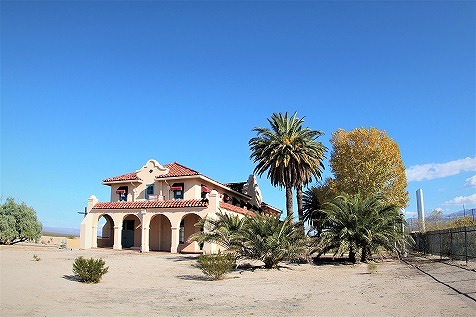
About one kilometer from the point where the straight road begins, there is a road branching off to the right. This road leads to Cima, a ghost town, and further south to Kelso, where you’ll find the Mojave National Preserve Visitor Center. Continuing even farther south connects to U.S. Route 40, so I see traffic along this section. However, once passing this right turn, the road ahead leads toward the abandoned town of Ivanpah, and beyond that, it becomes an unpaved track — where I rarely see a vehicle.

At this spot, where almost no cars pass by, I recommend stopping by the roadside and taking a moment to look at this long, straight road. Perhaps because there is so little traffic, the pavement remains in relatively good condition. Take a moment to enjoy the contrast between the vast wilderness and this single stretch of man-made road.
■ Old National Trails Highway (California)
This area, in the southeastern part of California, corresponds to what is known as Route 66. The official name of Route 66 is the National Old Trails Road, but the section here is also referred to as the Old National Trails Highway.
To reach this place, first drive from Los Angeles along Interstates 10 and 15 to Barstow. From there, take U.S. Route 40 west for about 80 kilometers and exit at Ludlow, where the Old National Trails Highway begins. Ludlow has little more than an old motel, a café, and a gas station. The motel and café, however, have a retro charm that evokes the feel of classic America. Although Route 40 is an interstate, parts of it cross the Mojave Desert, and traffic is light. Once entering the Old National Trails Highway, the number of cars drops even further. Rarely is a vehicle seen, and it is uncommon to pass another car at all.

About 30 kilometers west of Ludlow, the road passes what was once a café at a place Bagdad, and from there, the first straight stretch begins toward the next town, Amboy. The road slopes gently downward and then rises slightly at a certain point, creating the effect of the road being drawn into the horizon. In the distance on the right is the Amboy Crater, while a chain of mountains can be seen on the left. Approximately 200 meters to the left of the road, a railway runs parallel to it; in my photos, freight cars are visible on the tracks. Incidentally, this area holds a record for going 767 consecutive days without rainfall.

After passing Amboy, with the iconic Roy’s Motel & Café in view, a straight stretch of road appears just before reaching the town of Chambless. On the right, the sign of what was once the Roadrunner’s Retreat Restaurant comes into view. The scene evokes the bygone era when this section of Route 66 was a vital transcontinental highway, offering a glimpse of classic America.


■ Amboy Road (California)
This is the road connecting Amboy and Twentynine Palms in southeastern California. The distance between the two towns is about 70 kilometers, and the only establishment along the way is the Palms Restaurant, just before Twentynine Palms in Wonder Valley. Otherwise, there is nothing. Traveling from Twentynine Palms toward Amboy, the route first passes through hilly terrain. After clearing the hills, a vast expanse of wilderness opens up, and a perfectly straight road appears. The section where the road seems to be drawn into the distance appears white. This is the Bristol Dry Lake, a dried-up salt flat. The sight suddenly emerges before the eyes, leaving a striking impression.


The sight of the straight road, subtly winding through the green of low shrubs, disappearing into a landscape of blue sky, rocky hills, and surreal white expanses, is breathtaking. I have driven this Amboy Road three times, but on the first two occasions, traveling south from Amboy, I did not notice this spectacular view. Ideally, I would have liked to stop here and take in the scene for as long as I wished. However since I was filming a video, I did not pause. Next time I pass through, I want to stop and experience this space fully with my own body.
■ Interstate 246 (Arizana)
Northern Arizona. This is a memorable place where I first felt the impact of a perfectly straight road after beginning to drive through the American wilderness. It was near the starting point for traveling U.S. Route 246. It runs east-west across the Navajo Indian Reservation, after visiting Monument Valley. The western starting point is Tuba City. Route 246 continues all the way to Gallup, New Mexico, with the first half crossing open wilderness and the latter half dotted with towns. When I first drove this road in 1994, it was common to see Navajo people hitchhiking near some of these towns.


This spot is a short distance from Tuba City. Looking at notes written on the road map, an essential tool in those days before car navigation systems, it shows 24 miles from Tuba City. The view came into sight when the road climbed and opened up ahead. It appeared so suddenly that I slammed the brakes. After stopping on the shoulder to take in the breathtaking panorama, I made a U-turn to reach the highest point with the best vantage of the straight road. To fully appreciate such a straight stretch, the road ahead must slope downward. In this case, the steep descent made the view particularly striking. I lingered here for a while, reluctant to leave.
■ Indian Trail, Desert Heights (Carifornia)
In southeastern California, adjacent to Twentynine Palms, there is an area “Desert Heights”. Although it qualifies as wilderness, scattered houses can be found throughout the area. Roads run in all directions — vertical, horizontal, and diagonal, and most of them are unpaved. It was in this area, while exploring, that the view suddenly opened up when driving west along an unpaved road. The road slopes downward, leading straight toward distant mountains. The surrounding wilderness stretches out, dotted with low shrubs in a surreal pattern. When thinking of straight roads, paved surfaces usually come to mind, but in this respect, this is a rather unique place.

The location is along Pole Line Road and Sonora Road, which run east-west through the center of Desert Heights. This is an unusual stretch where the name of the road changes along the way. The eastern section is Pole Line Road, and it becomes Sonora Road partway through. The point where the name changes is on a small rise, providing a clear view of the surrounding area.
In this area, there are many places with similar landscapes, so wandering around can lead to unexpected views. The unpaved roads are sandy, and some spots might trap your vehicle, so take caution. In particular, Giant Rock Road, which runs diagonally from northwest to southeast of the town, has places where boards are left for vehicles that have become stuck. Care is needed, as even a momentary lapse can result in getting stuck.

■ Interstate 15 (Carifornia)
This is an interstate highway running from Los Angeles to Las Vegas. At the California-Nevada state line lies the town of Primm, known for its cluster of casino hotels. The straight stretch of road discussed here is located on Interstate 15, heading west from Primm toward Los Angeles.
As this road is a major route between Los Angeles and Las Vegas, traffic is heavy. Straight roads are often thought of as places with very little traffic, where cars are rarely seen. So in that sense, this stretch is rather unusual.


On both sides of the road lies Ivanpah Lake, a dry lake that gave me a rare sense of the vastness of the land. When I drove west from the town of Primm, looking toward the far end of the road, the straight stretch appeared to disappear into the horizon. Staring at that single point, I found it hard to tell exactly where I was. Because the road was perfectly straight and the surrounding scenery remained unchanged, I barely needed to steer, and even while traveling at speeds of 120–130 km/h, I could hardly feel how fast I was moving, creating a strange, almost surreal sensation.


I turned on the car’s cruise control and set the speed to 80 mph (about 130 km/h), lifted my right foot from the accelerator and brake, and focused my gaze solely on the road stretching toward the horizon. Occasionally, I glanced at Ivanpah Lake spreading out on either side, then returned my eyes to the road ahead. This sequence of actions put my mind into a state of “nothingness,” a process I had never experienced before. According to the map, this straight stretch is only about 15 kilometers long, yet every time I come here, I am amazed by this unfamiliar sensation and overwhelmed by the sense of being somewhere entirely out of the ordinary.
■ Kel-Baker Road (California)
This is a straight stretch of road between Baker, on Interstate 15 from Los Angeles to Las Vegas, and Kelso, within the Mojave National Preserve. It lies in the heart of the Mojave Desert. Travelers often use Baker as a rest stop when driving between Los Angeles and Las Vegas. It is also known to some as the location of the world’s tallest thermometer landmark.

There is a road heading southeast from the town of Baker called Kel Baker Road. After leaving Interstate 15, which I had followed from Los Angeles, I drive along a parallel road. At a signalless intersection in the center of town, I turned right. Passing over an overpass that crosses Interstate 15, the landscape opened up to nothing but empty desert on either side. I feel enveloped in a world of silence. After driving for about ten minutes, a straight stretch of road appeared. The road continued toward the mountains ahead, seemingly being drawn into them. It may sound cliché, but the view was beautiful.

Considering the presence of Baker, a relatively large town, it is remarkable that this view appears just a short distance away. Despite Baker’s existence, there is very little traffic on the road. Moreover, the FM radio signals that could be picked up in Baker quickly disappear once leaving town (this was in the past, though). In Baker, I see people, fill up on gas, and eat at a restaurant, but the stark contrast with the emptiness of the road beyond may be one reason the scene feels so striking.
Continuing along this road for about another 30 minutes leads to Kelso. The town functions as a railroad station but can also be described as somewhat of a ghost town. A European-style station building stands there, now serving as the visitor center for the Mojave National Preserve. It is a place full of character and well worth a visit.

(Visited since 1995)
Basic Information
■ Maps are included below each of the locations mentioned above.
(described on Oct 18 2025)
